Eliška Klimešová
SELECTED WORKS
Variations
Beyond Language
A Relational Situation
I Remember How It Didn't Happen
Is that really necessary?
I Change It For You
(in)visible processes
In the Time of the Image
Bromoil prints
Footnotes
BOOKS / ZINES
Women Readers
Imprint of Reality
Fragments from Soutok
Change of Narration
About
Contact

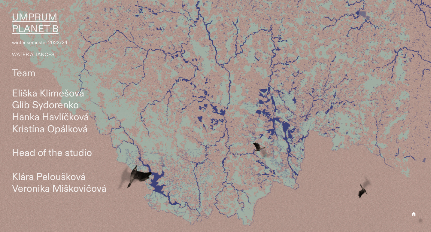
Fluid Cartography
(2024)video 2'48, website
cooperation with: Glib Sydorenko, Kristina Opálková, Hanka Havlíčková
Created during intership at Planet B (UMPRUM) under supervisors Klára Peloušková a Veronika Miškovičová.
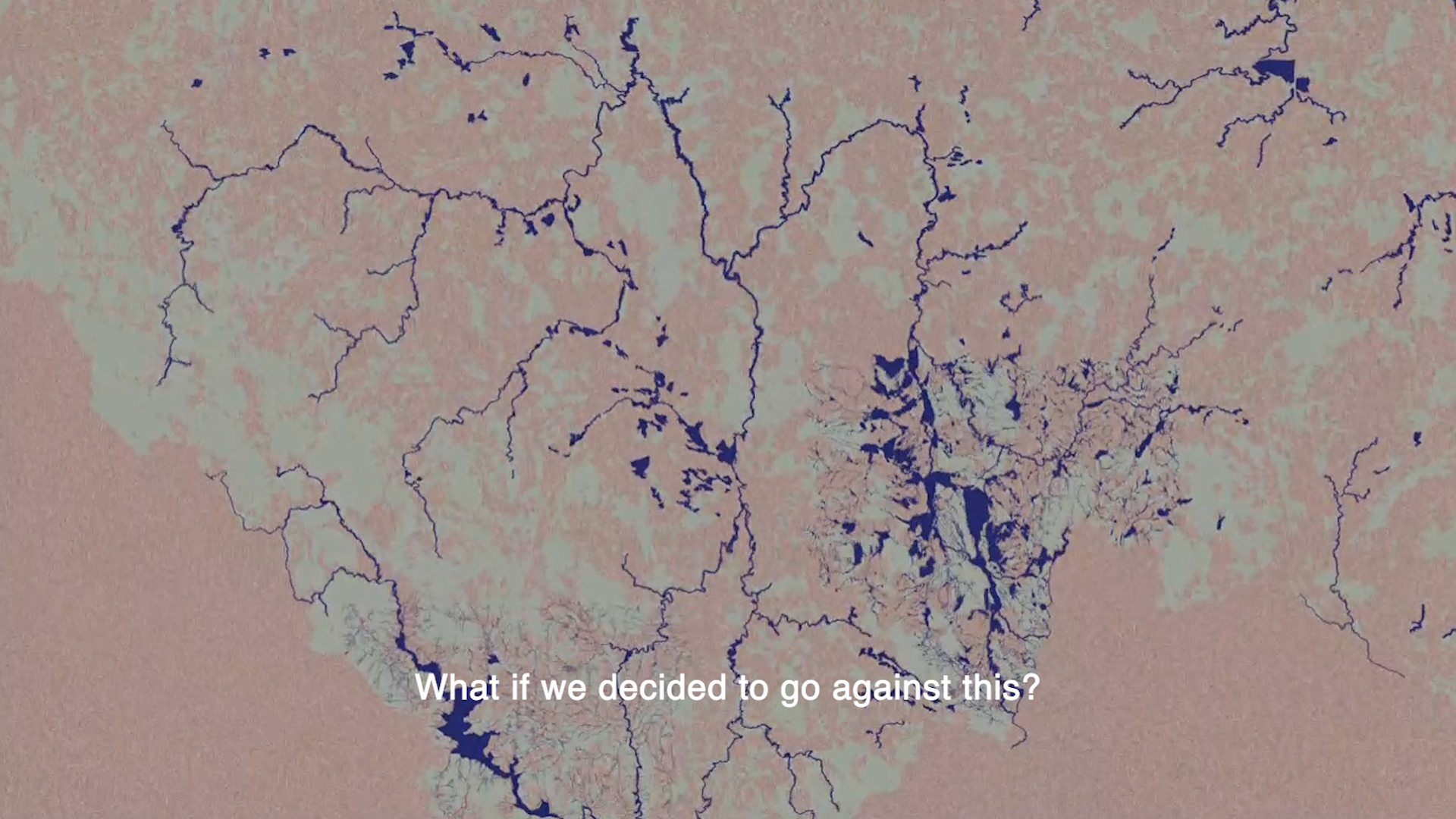
The main focus of the Fluid Cartography project are rivers and other surface water bodies – their evolution induced by climate change and the abundance of living and non-living entities they consist of. Altered biophysical processes manifested in extreme weather events and destabilized flow rates instigate a closer consideration of the conventions of water streams’ visual representation. The project suggests that in the near future, static cartography (or hydrography) might not be entirely suited for the mapping of the changing hydrological dynamics. Moreover, the very concept of map making as an established, institutionalized practice, may hinder our understanding of the multifaceted implications of climate change itself. What if instead, we chose to represent water systems as a web of fluctuating relationships and interactions?
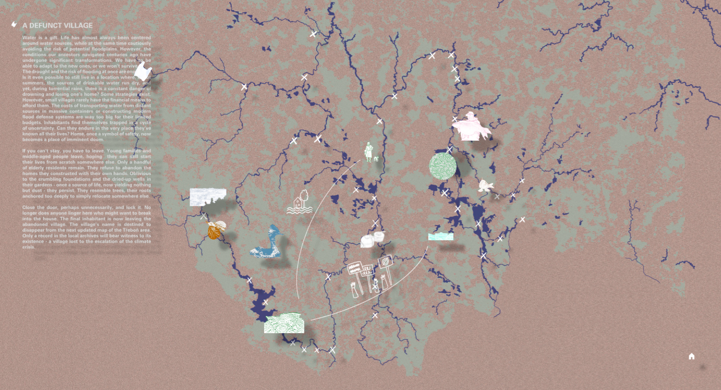
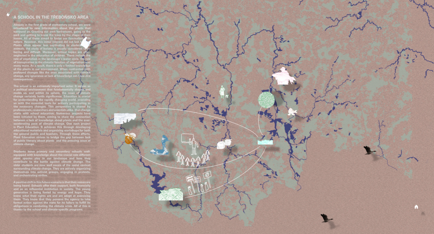
The project revisits the universalist, anthropocentric approach to mapping that tends to reduce or overlook diverse aspects and actors of a given territory. It aims at creating an alternative cartographic tool that foregrounds environmental processes and dependencies among various entities and draws attention to the hardly visible struggles they’re facing due to the changing hydrological conditions. Stories of living organisms, institutions or infrastructural facilities become a substantial component of a map: together, they form an intricate, fragile network of fates and prospects.
The proposed way of representation defies abstraction as a foundational principle of cartography. The team focused on a specific area: the aquatic ecosystem of South Bohemia, near the town of Třeboň. The stories the “fluid” map tells narrates both the history and the future of various entities that are bound together by the common denominator of climate change and its impacts on the local ecosystems and the global water cycle. The landscape of South Bohemia is interlaced with water bodies, be it rivers, artificial waterways or ponds built in high density over the past five centuries. Eurasian carps, cyanobacteria, black-necked grebes, phosphorus or nitrogen, sewers, alder trees but also long forgotten defunct villages are mutually entangled in a complex web of uneasy, often ambivalent relationships mediated by water. Is climate adaptation possible without actually acknowledging these dependencies and what kind of practices would emerge if we embraced the fluidity of territories we try to map?
text from video:
Imagine a map of a river. You see thin lines representing small streams and springs, lines that are getting wider and wider as the river flows. Sometimes you see uneven spots of blue color - lakes, ponds, wetlands. Black dots represent cities and villages built next to these water sources.
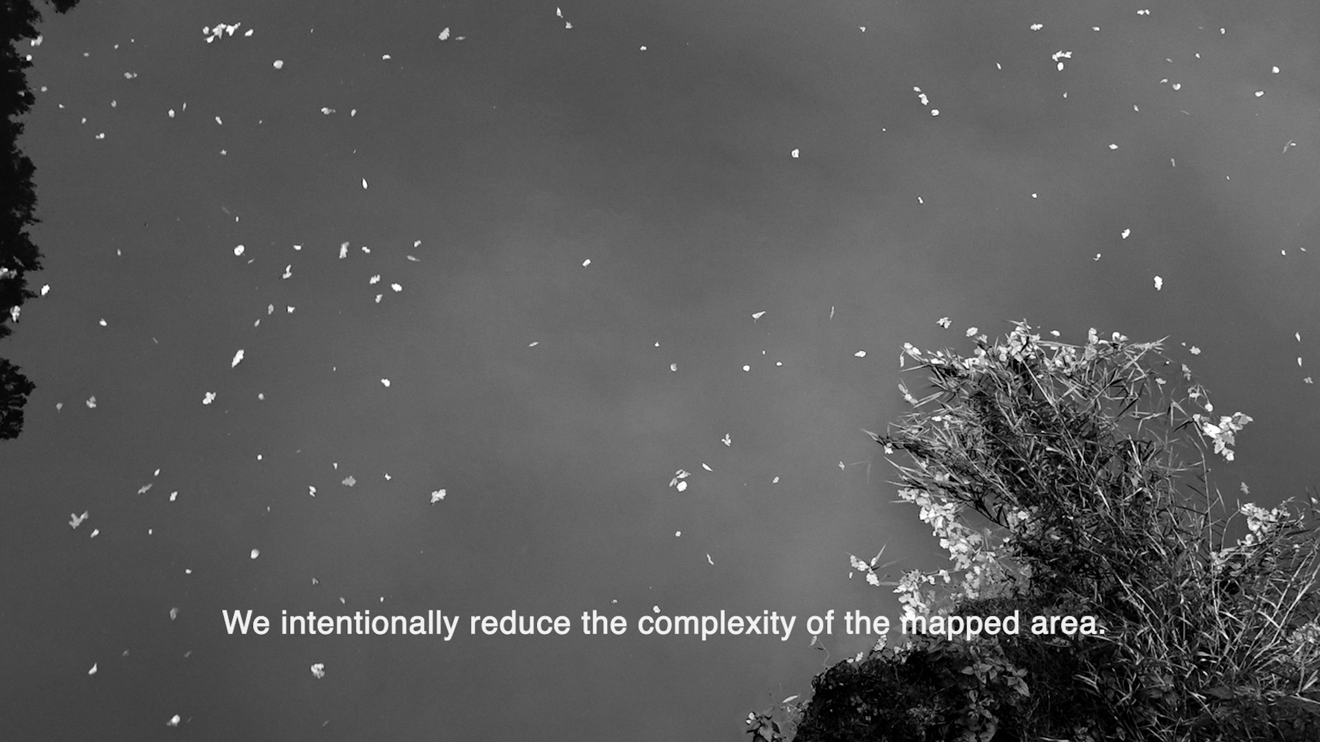
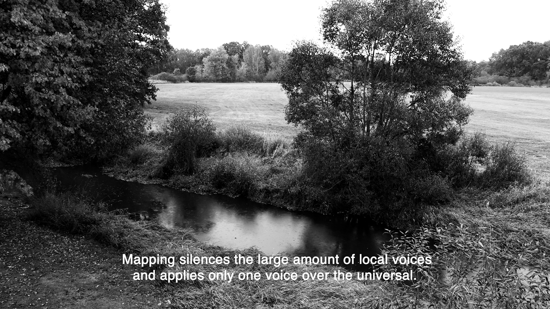
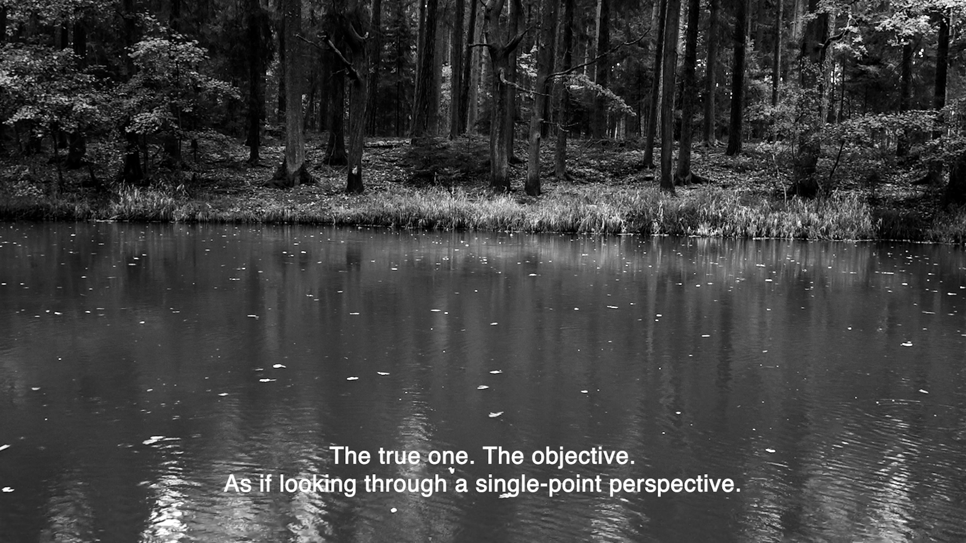
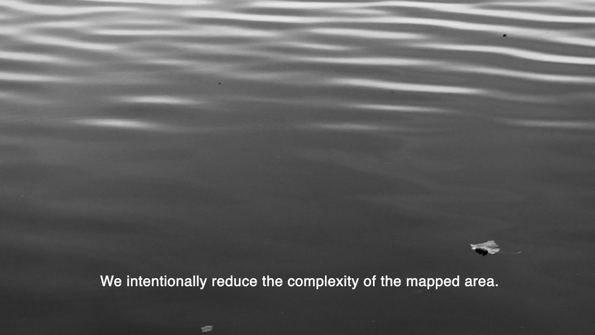
For centuries people have been using maps as a tool of power. Mapping silences the large amount of local voices and applies only one voice over the universal. The true one. The objective. As if looking through a single-point perspective. We intentionally reduce the complexity of the mapped area. What if we decided to go against this? What if we admit that every voice present there deserves to be heard?
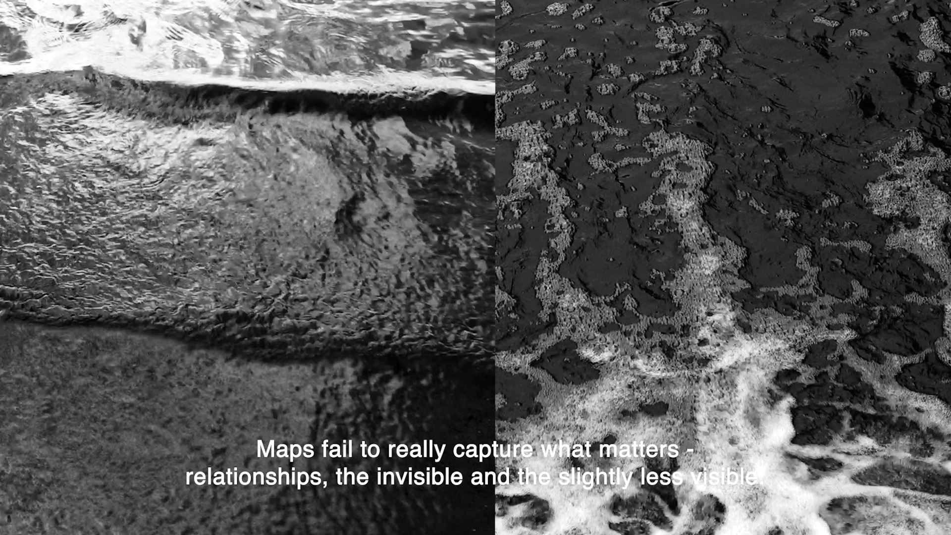
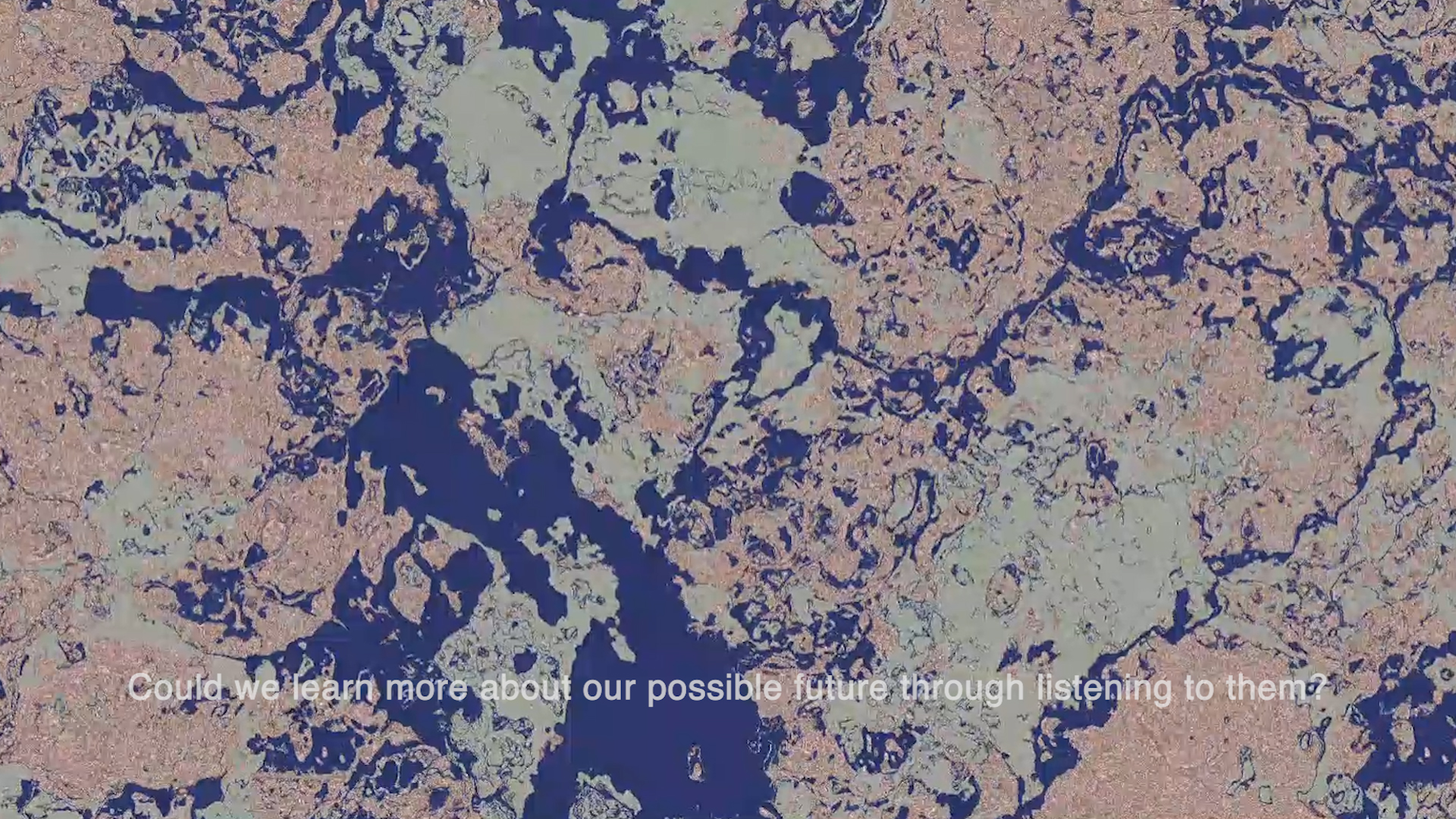
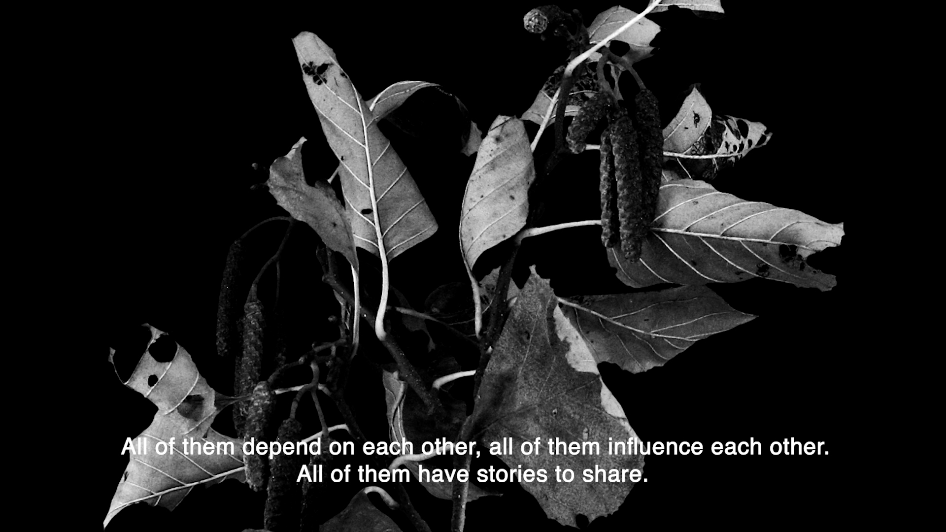
The problem with maps is that although it might seem as a perfect representation of a chosen space, it never is. Maps fail to really capture what matters - relationships, the invisible and the slightly less visible. Because the river is not just a blue squiggly line. It is a network connecting animals, people, plants, objects, the living and the non-living, policies and power structures. All of them depend on each other, all of them influence each other. All of them have stories to share. Could we learn more about our possible future through listening to them?


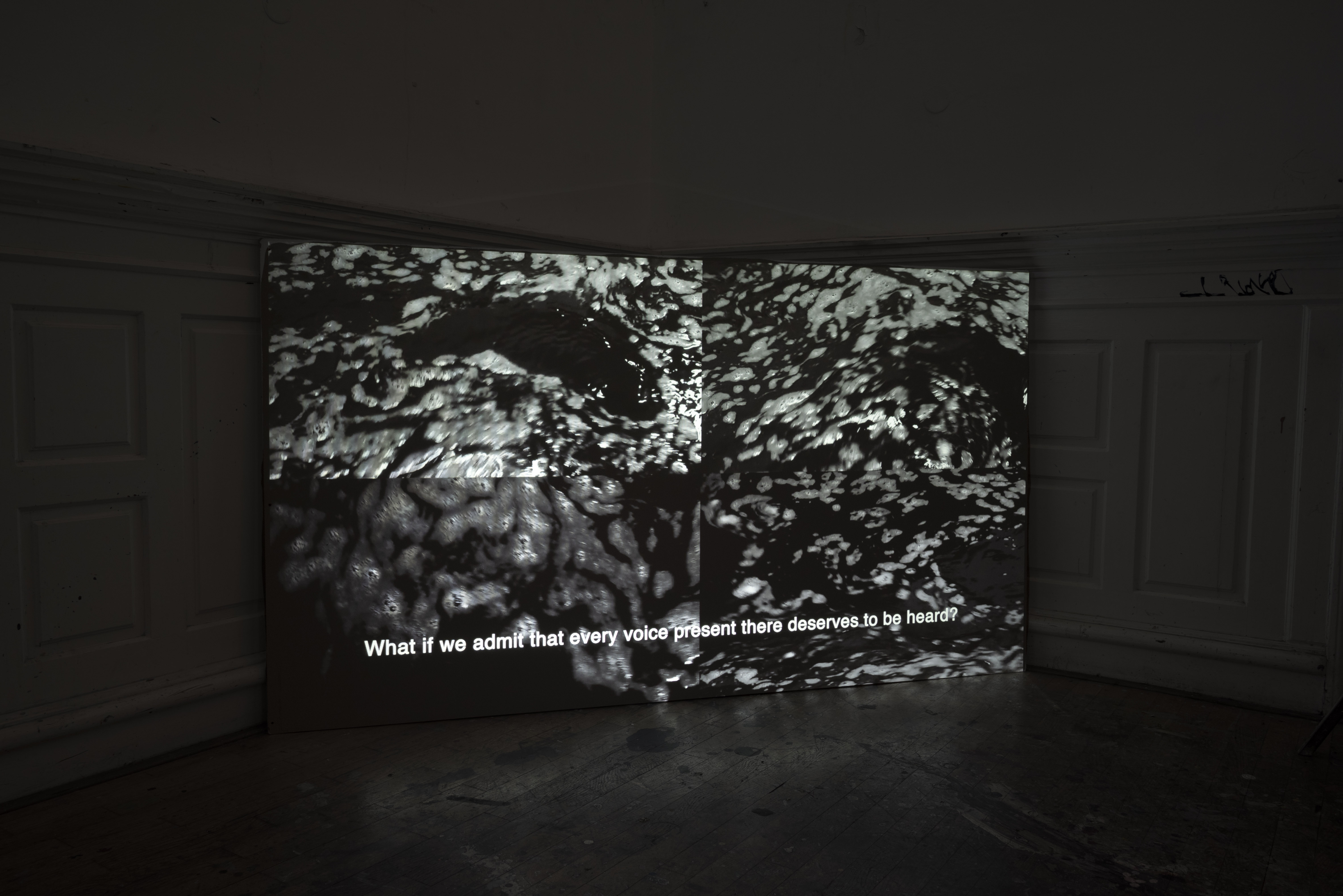

Photos from installation during winter Artsemester at UMPRUM
Screenshots from website:


Stills from video: